Workshop on Pervasive Urban Applications (PURBA)
On June 12, I attended the First Workshop on Pervasive and Urban Applications (PURBA) @ Pervasive 2011 (San Francisco). The two keywords that this workshop was designed around (pervasive & urban) explain why I was there: for anyone researching and building technology that they hope to see used in the wild someday, there are fewer things more exciting than cities and the people who move around them.
Papers & Presentations
Here is a list of the papers that were presented, along with a few notes. My notes do no justice to the papers themselves, which I suggest you read for full details. I’ve grouped the papers by theme.
Applications
“Identifying and Understanding Urban Sport Areas” [pdf]. This paper focused on sport tracking applications (in particular: mysportpals.com). The data they have can be used to visualize where and how people go for runs within the confines of urban areas. One of the attendees asked an interesting question: how could this tool be used to help people discover places to work out where there are no crowds? Of course, a user of this kind could simply go running where the map says he should not go. However, more could be done: what about the relationship between the design of the built environment and its usage? The app could, for example, report crowding levels as well as locations (e.g., parks) that were built for urban sport but are not used.
“A Centralized Real-time Advanced Driver Assistance System Based on Smartphones” Andrea, from Milan’s Politecnico, presented his work that is part of the EC SAFE SPOT project. The core idea is that by tracking drivers with their mobile phones, accidents can be avoided with timely alerts.
“Driving Innovation in Urban Computing With a Community Testbed.” [pdf] The presentation began with an interesting comparison: physicists have the large-hadron collider for their experiments, so why don’t ubicomp researchers have a similar testbed for all their experiments? This is exactly what they are building in Oulu, Finland: a unified testbed for urban computing. While this is a great effort, I wonder whether the analogy of a hadron collider is appropriate: physicists are looking for universal laws, but aren’t we also to cater for the cultural, geographical, and design differences between urban areas?
“Fu Chi: A Mobile Communication System for Philadelphia’s Chinatown” [more details] The name Fu Chi stands for “Future Chinatown.” In this case, the Chinatown in Philadelphia - where the authors are testing a tool to help residents overcome communication barriers between the locals and the community around them.
Analyzing Mobile Phone Data.
I don’t know if I heard any sentence more than “data from mobile phones” throughout the day. The following papers inferred land usage (for example: work and recreational areas) from mobile phone records. Researchers also cluster users’ call patterns, and then looked at the locations of a particular cluster of users (inferred as students) to seek for clues that confirm who these people are (i.e., are there schools near the towers?)
“Robust Land Use Characterization of Urban Landscapes using Cell Phone Data” [pdf]. Presented by Enrique (from Telefonica I+D Madrid)
“Clustering Mobile Call Detail Records to Find Usage Groups.” [pdf] from folks from AT&T.
“Exploring the Relationship between Land Use and Mobile Phone Usage: Analysis of a Dataset for the Amsterdam Metropolitan Region.” A collaboration between MIT’s Senseable, University of Salzburg, Vrije University, and the CurrentCity foundation.
“Spatial structure and Dynamics of Urban Communities” by Fergal from the National Centre of Geocomputation.
Taxi/Travel Data
Data from taxis sounds like buckets of fun. Not only can you use it to explore how people move, but there is interesting potential for applications, such as helping drivers find their next ride and passengers find their next taxi. Can taxi traces reveal the different roles they place in urban mobility? Does trip duration and income flow any well known distribution? Can we define better strategies from taxi traces resulting in higher mobility? Two papers at the workshop were looking into these ideas:
“Predicting Urban Human Mobility Using Large-Scale Taxi Traces”
“Exploratory Study of Urban Flow using Taxi Traces”
And, of course, the rest of the papers:
“Sensing The Urban: Using location-based social network data in urban analysis” [best student paper pdf] Anil, from UCL CASA, presented his work analyzing and comparing the Foursquare check-in data that he has crawled from three cities (New York, London, Paris).
“Digital Archiving of People Flow using Person Trip Data of Developing Cities” A practical method for re-constructing people’s flow from fragmented mobility data.
“Bridging the Social and Physical Sensing Worlds: Detecting Coverage Gaps and Improving Sensor Networks” Can we use social data to understand the city? Most urban data is based on physical sensors; most online data is highly rich and contextual. Can the two be used to compliment one another?
“Autopoiesic Content: A Conceptual Model for Enabling Situated Self-generative Content for Public Displays” Self-regenerating content for LCD panel systems.
“Enabling Real-time City Sensing with Kernel Stream Oracles and MapReduce” The authors talked about using the power of Map-Reduce to process large-scale sensor data. Check out the i2maps project.
“Influence of User Choice on Perception of Wireless Connection Genuineness and Security” Researchers are investigating issues surrounding trust in pervasive computing. A great example was the link to the way the Internet works in the hotel: how do we know to trust a piece of paper put on a table?</li>
Wordle
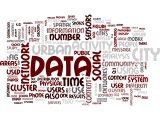
Below is a wordle (made by Martin Wirz) of the workshop proceedings:
